ENVIRONMENTAL VISUAL COMMUNICATION
Wildfire Crisis Strategies Illustrations
Front Range Forest Landscape, Colorado
Client: U.S. Forest Service | Arapaho and Roosevelt National Forests
LVB provided custom maps and illustrations to help the U.S. Forest Service communicate its wildfire crisis strategy to national legislators and policymakers.
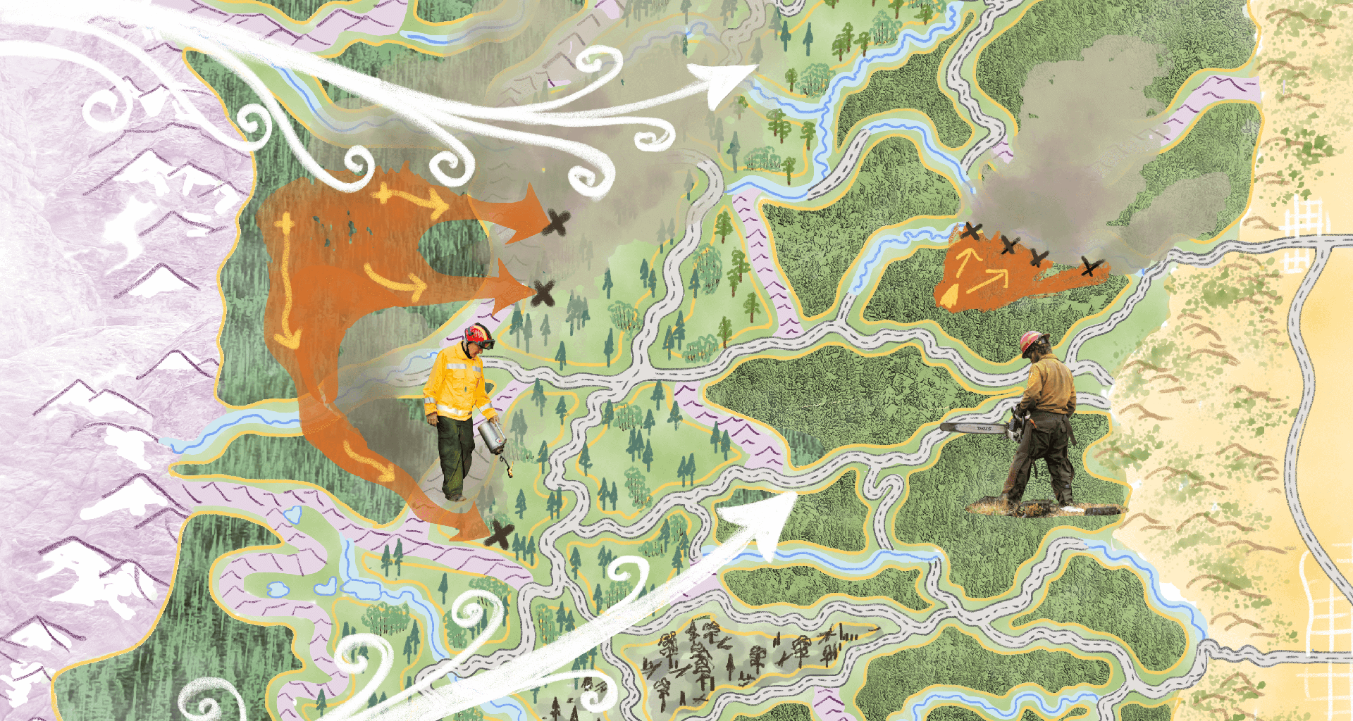
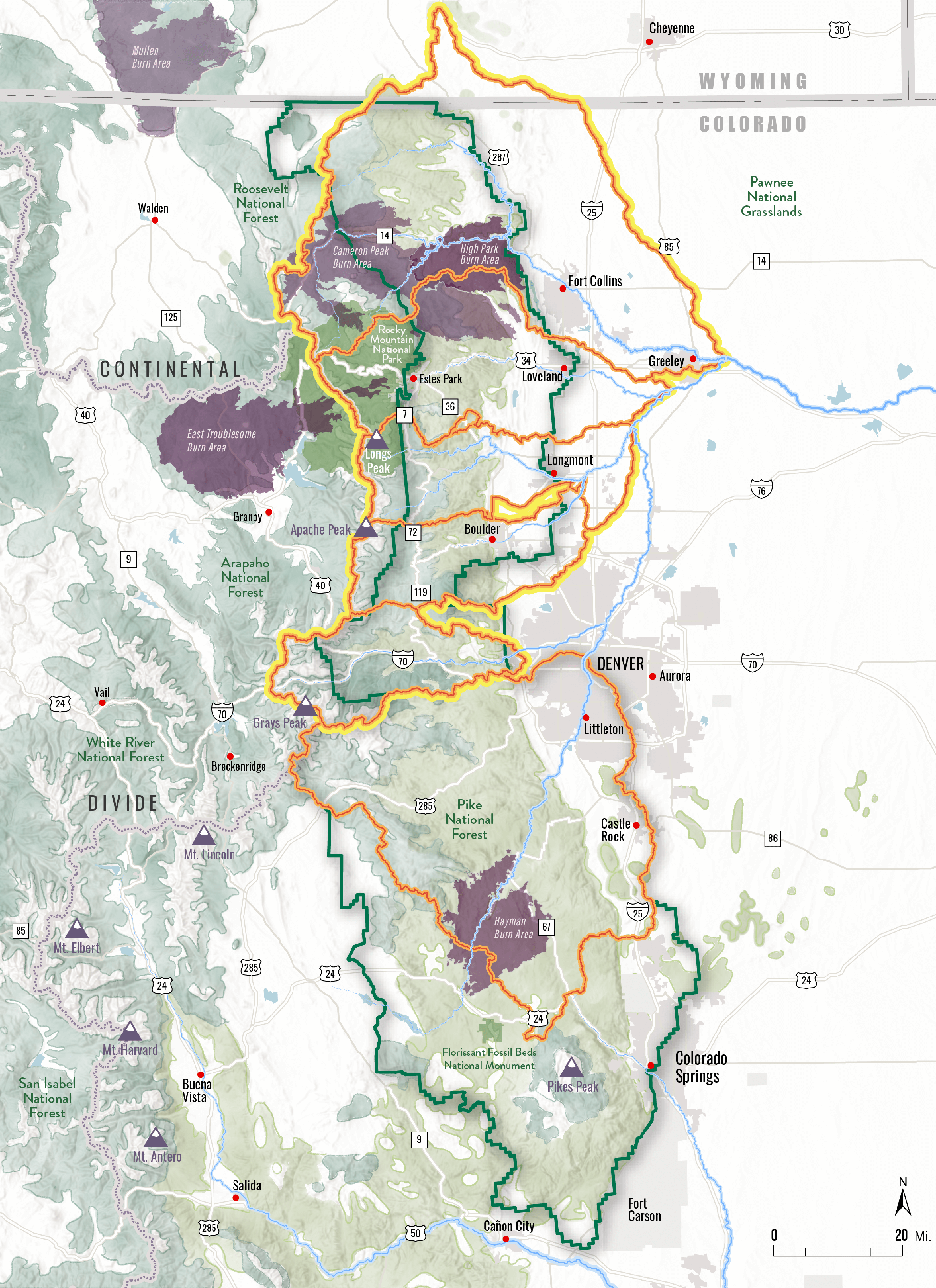
Products included an ‘impact map’ of the nationally designated landscape boundary and partnerships; an illustration of the strategic ‘PODS’ network approach to managing fuel along river corridors, ridges, and roads; and the landscape-scale ‘green ribbon’ treatment running north-south along the Front Range.
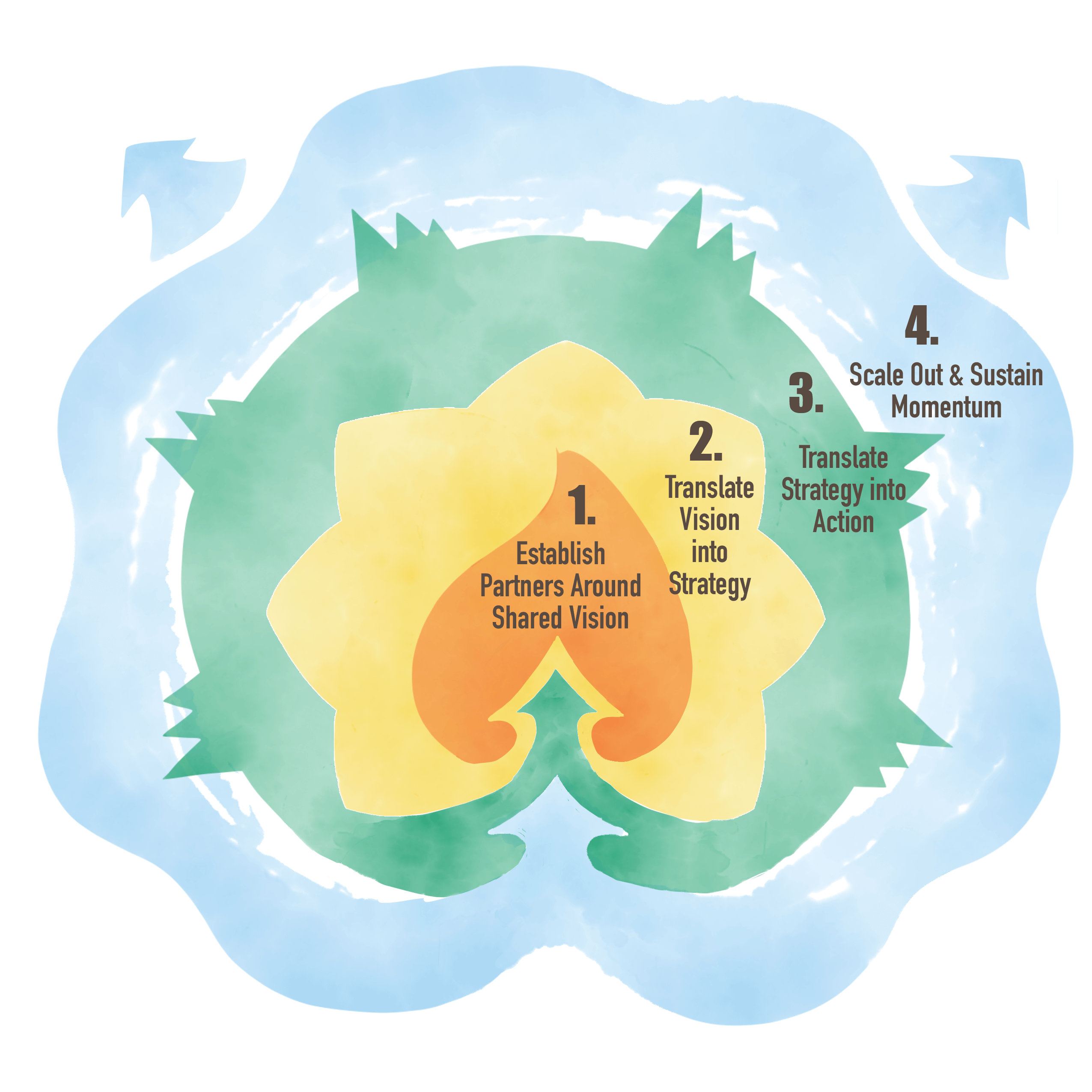
The ‘stages of readiness’ graphics, icons, and diagrams communicate the nested and growing capacity of place-based community partnerships, such as the Northern Colorado Fireshed Collaborative, to expand the rate and scale of wildfire prevention and forest management projects from the Wyoming border to Colorado Springs.
POD & GREEN RIbbon DIAGRAM

WIldfire crisis Strategy – IMpact Map


