River Corridor Planning | Flood Resiliency Planning
Lower Poudre River Flood Recovery & Resilience Master Plan
Client: Coalition for the Poudre River Watershed, Team: Lynker Technologies, Otak
Cache La Poudre River, CO | 2017
In response to the devastating 2013 floods, the Coalition for the Poudre River Watershed hired the Lynker Tech team to develop a flood recovery master plan for 36-miles of the Lower Cache la Poudre River. The effort combined scientific river engineering analysis with community outreach to prioritize river health and resiliency. Extensive landowner engagement helped to identify areas and issues of concern and map community assets.
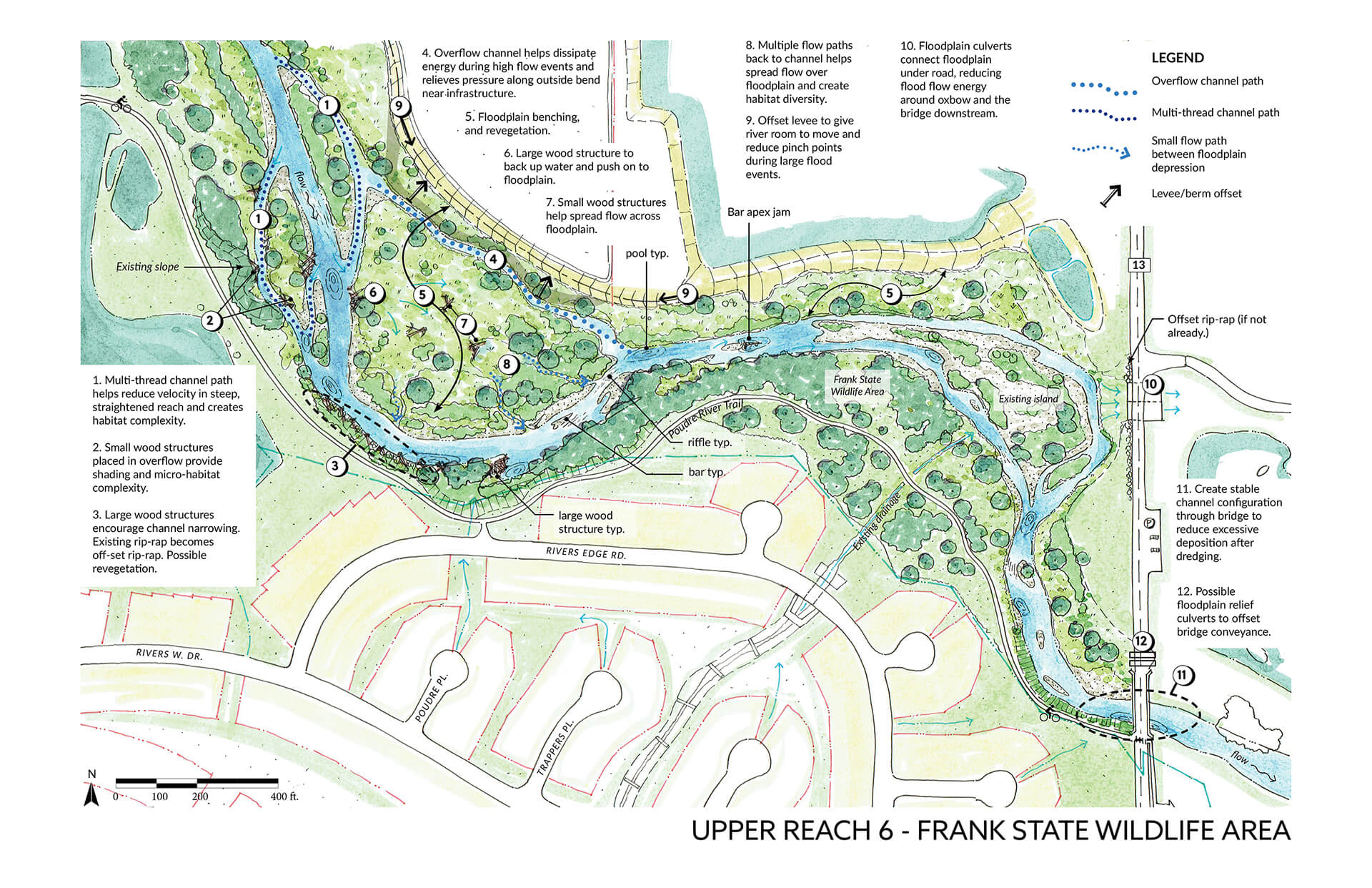
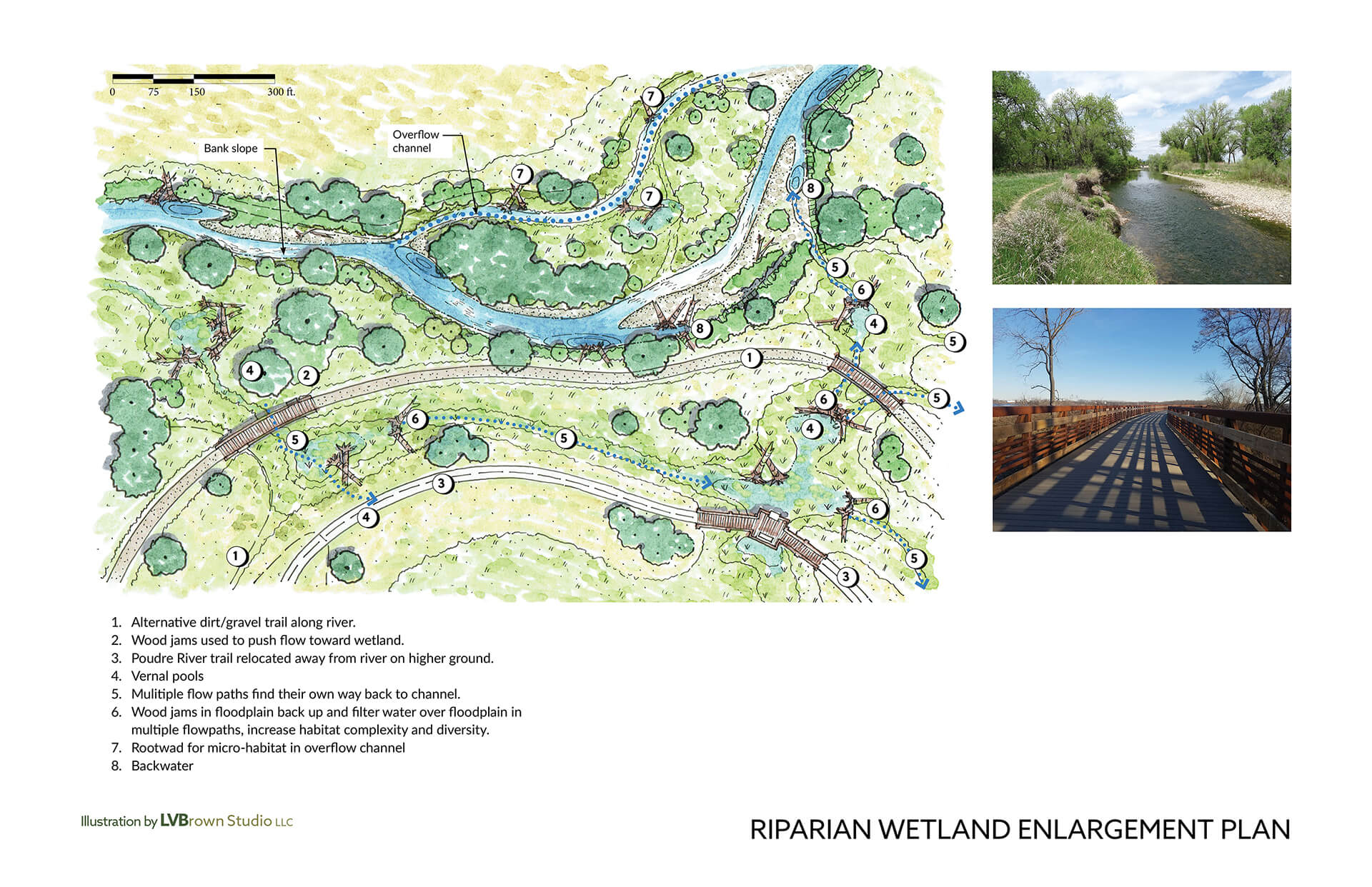
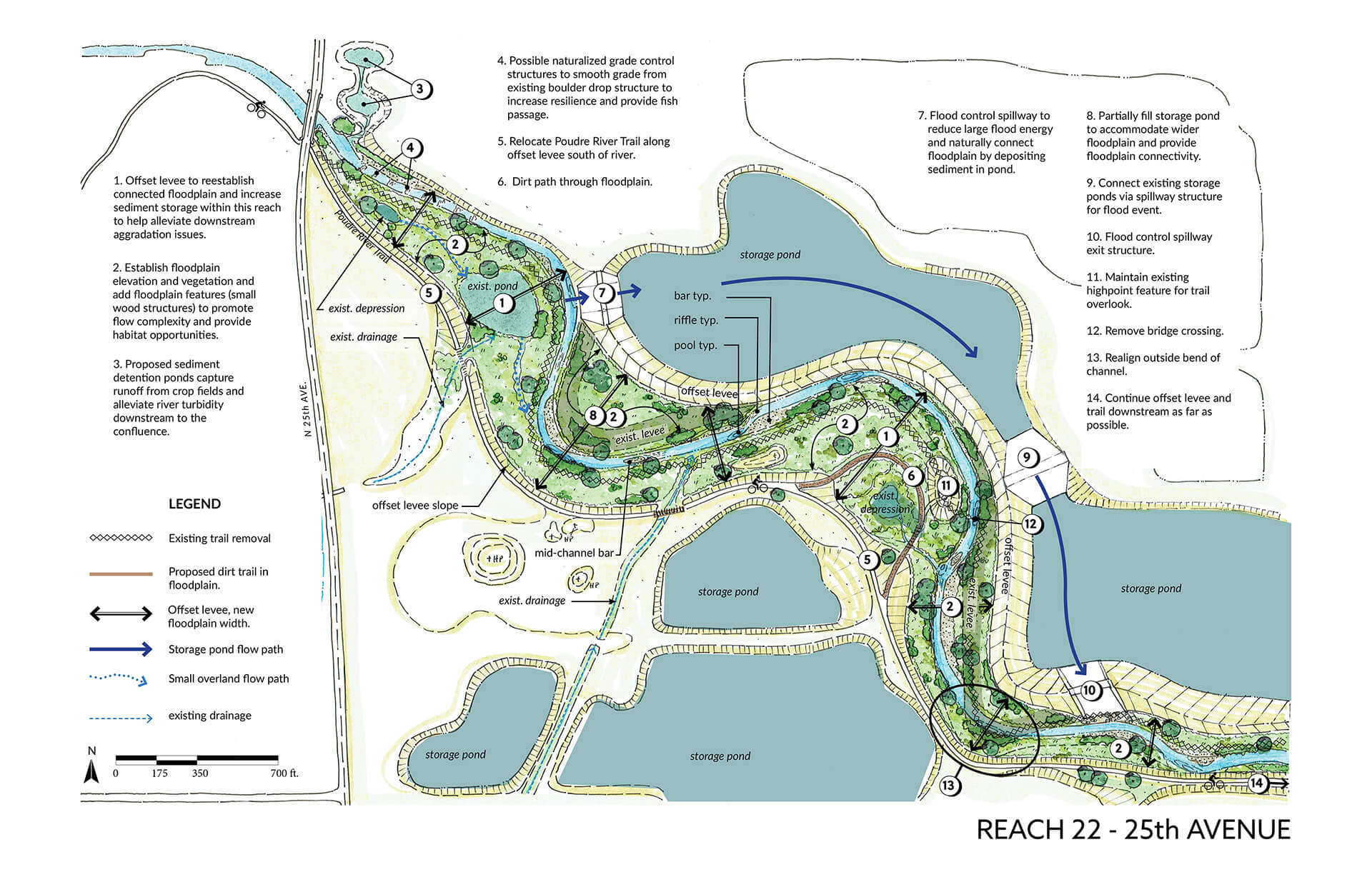
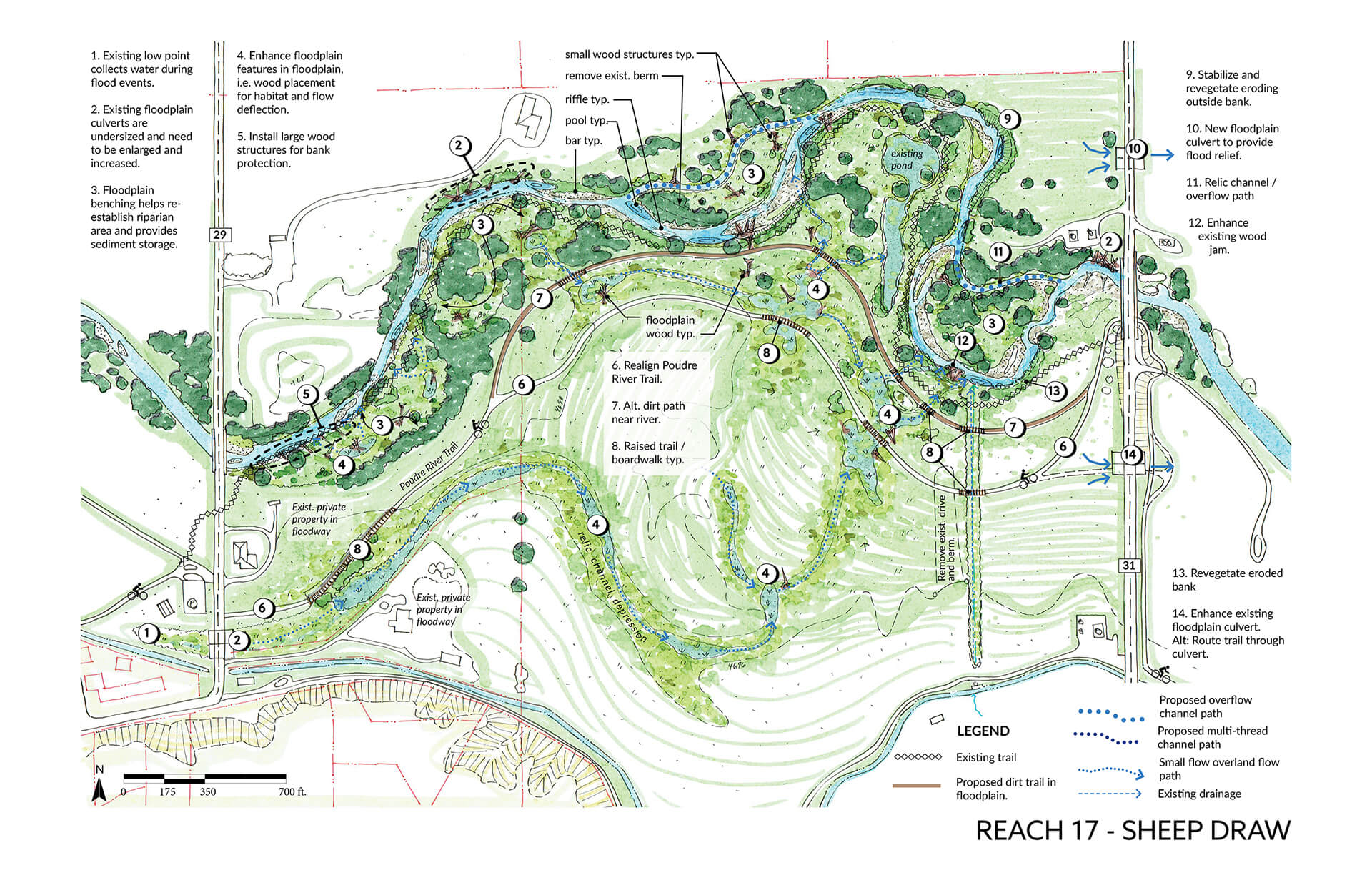
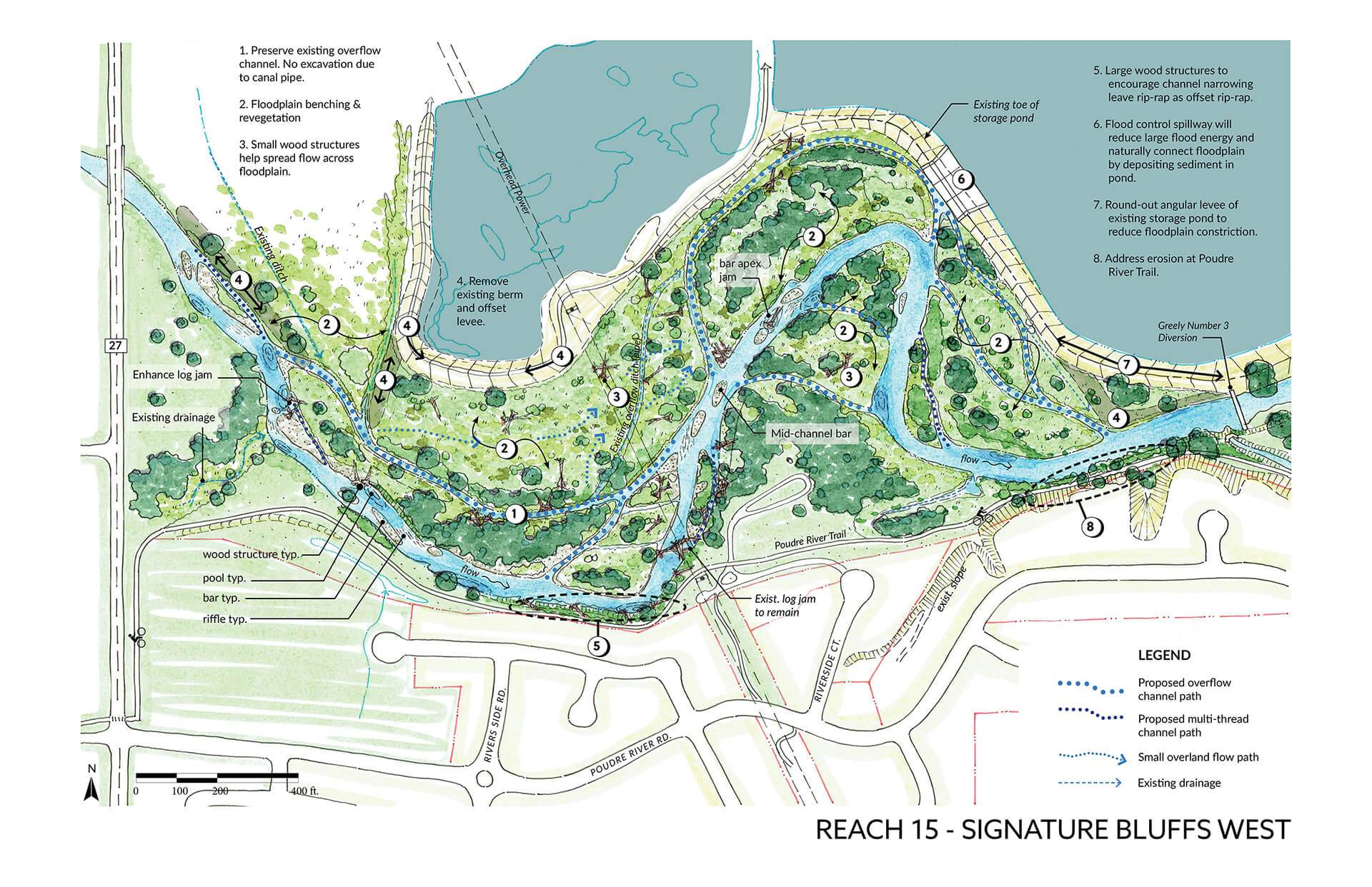
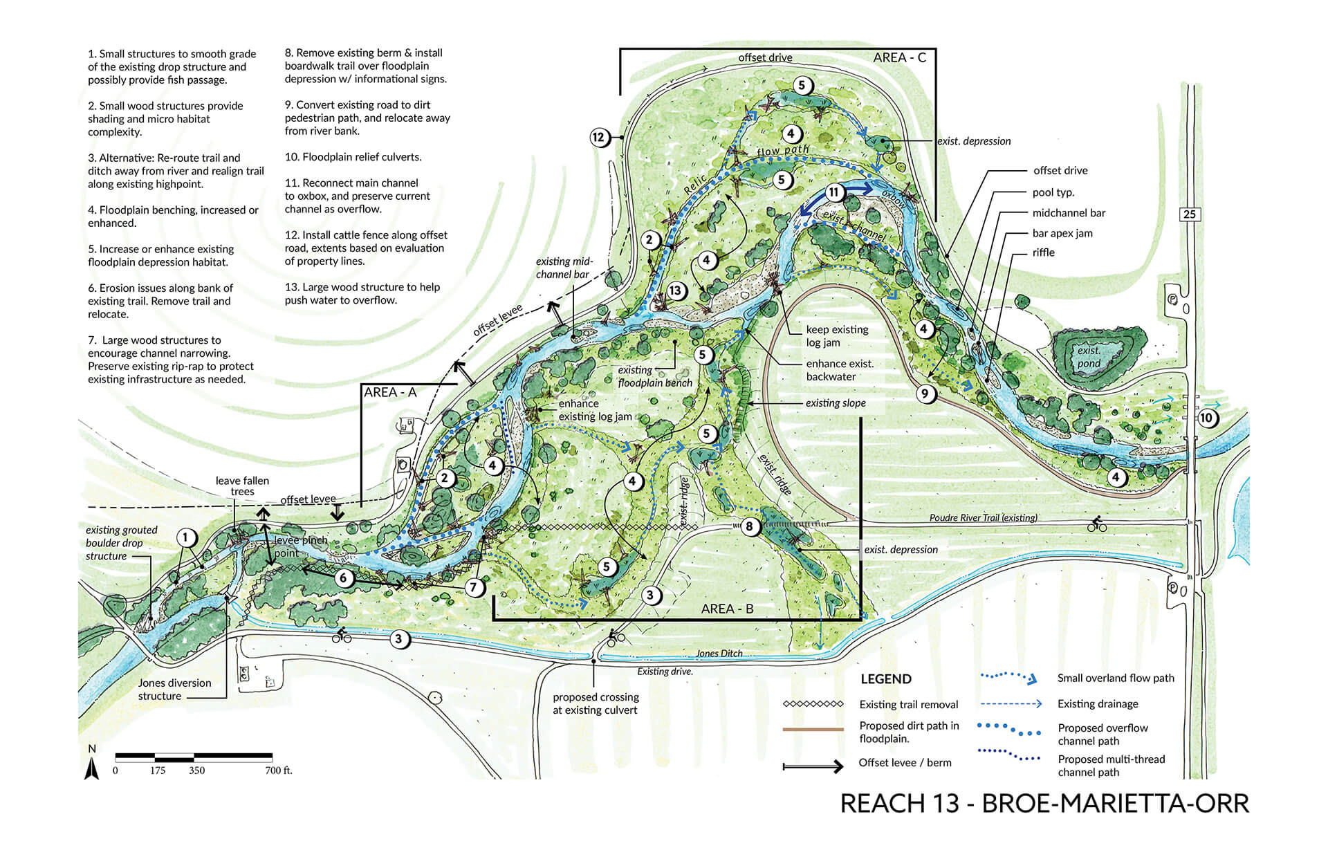
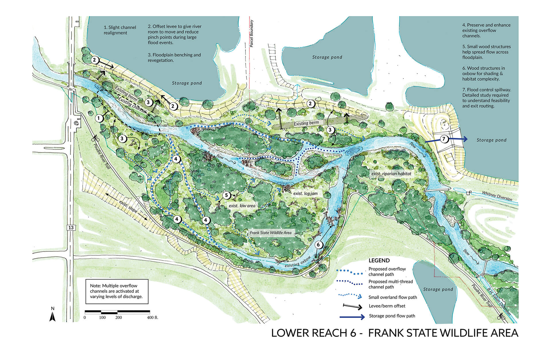
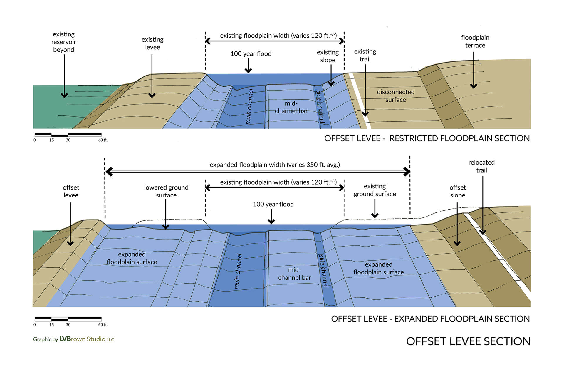
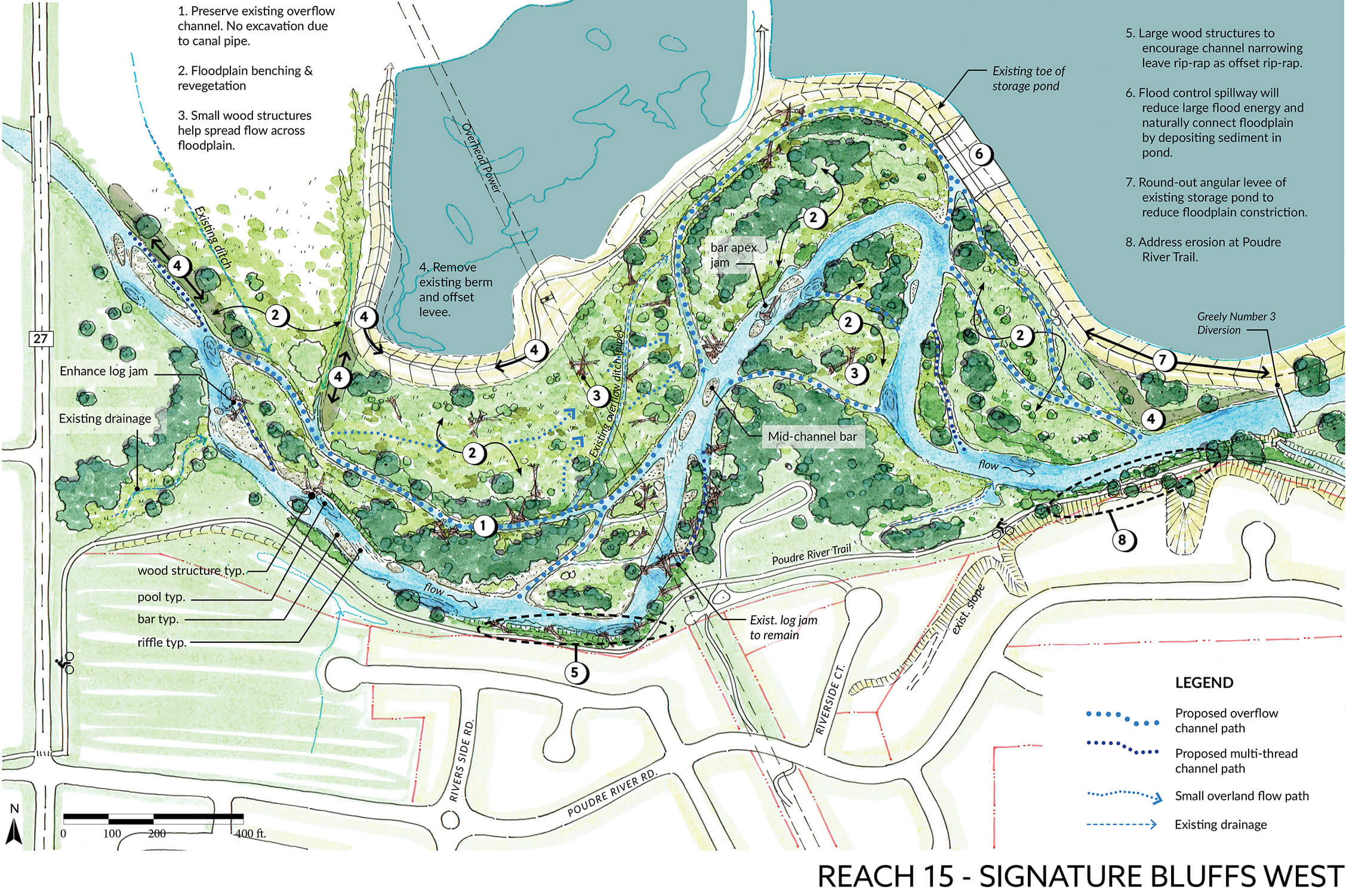
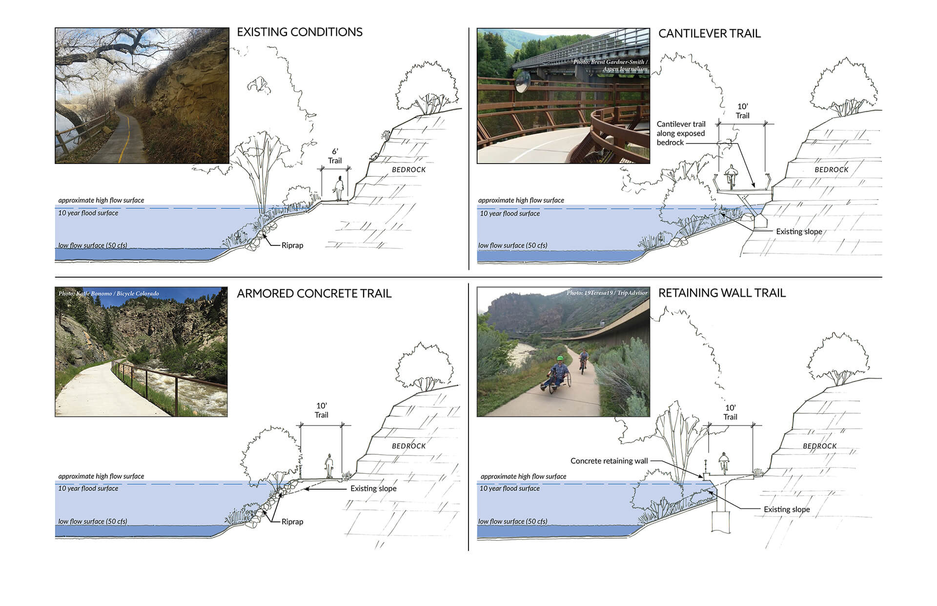
LVB developed conceptual design plans for the river’s highest priority reaches, showing the pre-flood and post-flood channel, ecological vegetation communities, and recreation trail corridor. Adaptive river restoration strategies include floodplain scraping, offset-levees, and overspill structures to connect flood flows to adjacent reservoirs (i.e., historic gravel mine pits.)
The Master Plan was complete in November 2017 and continues to guide restoration efforts along the river corridor.
ESRI Story Map
Learn more about the process and product of the Master Plan process by viewing Lynker’s ESRI Story Map.
Click image to expand and scroll through plan renderings of highest priority reaches.

