Environmental Illustration
Left Hand Creek Illustrative Conceptual Model & Adaptive Management Guidebook
Client: Left Hand Watershed Center, Lynker Technologies Inc.
Front Range, CO | 2018
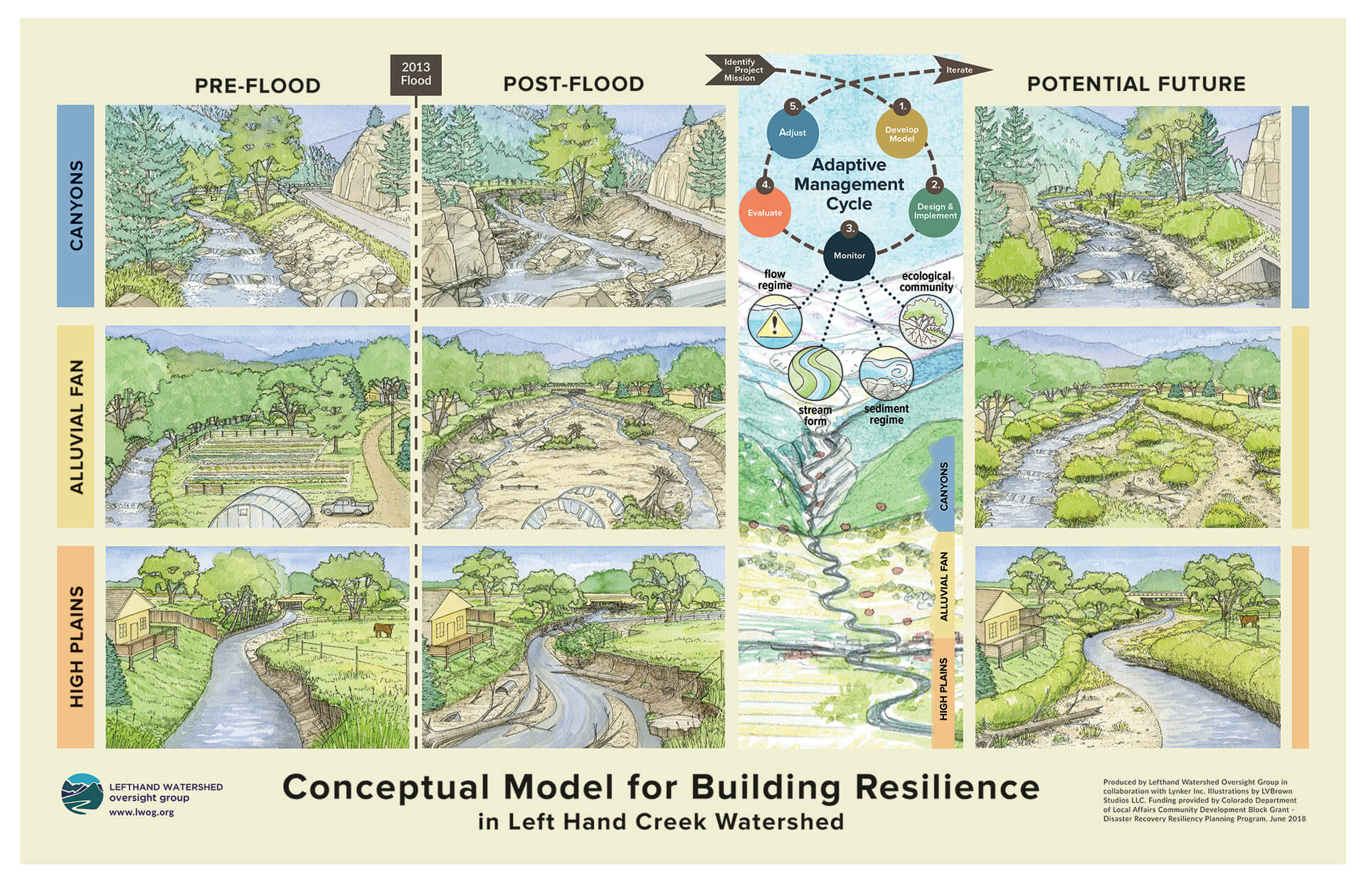
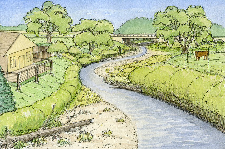
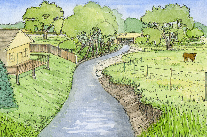
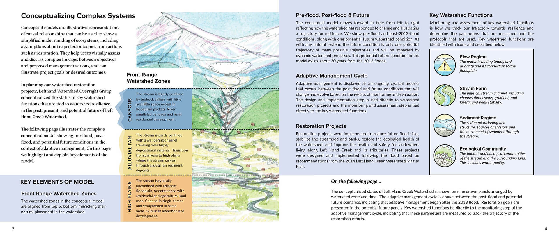
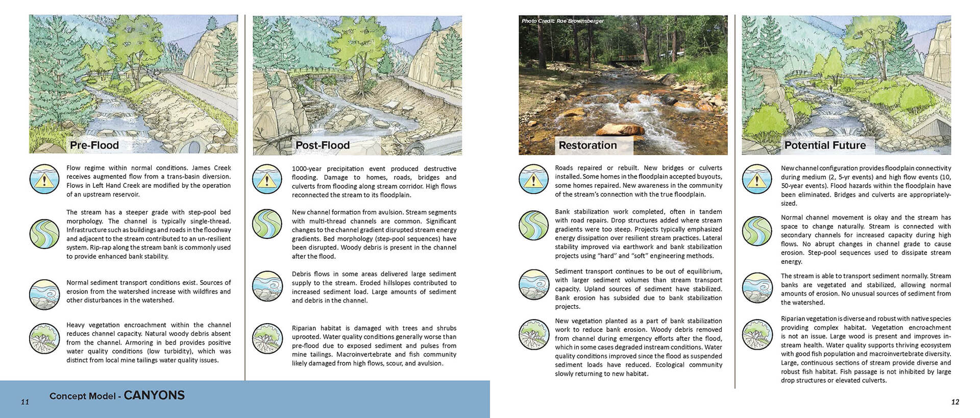
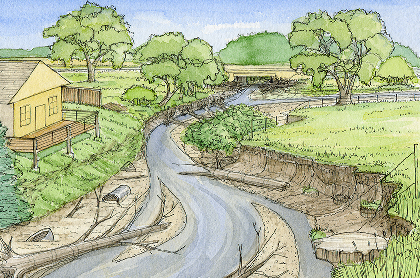
LVB teamed with Lynker and collaborated with watershed staff and local technical experts to develop an Illustrative Conceptual Model and Adaptive Management Guidebook design for the Watershed Center. LVB drew from academic and applied experience in natural stream restoration to imagine and illustrate Left Hand Creek from the canyons, alluvial fan and high plains into representative pre-flood, post-flood, and a future resilient conditions.
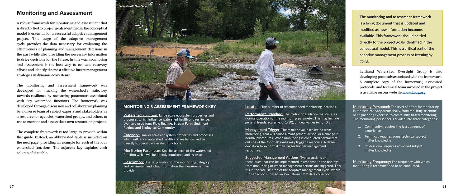
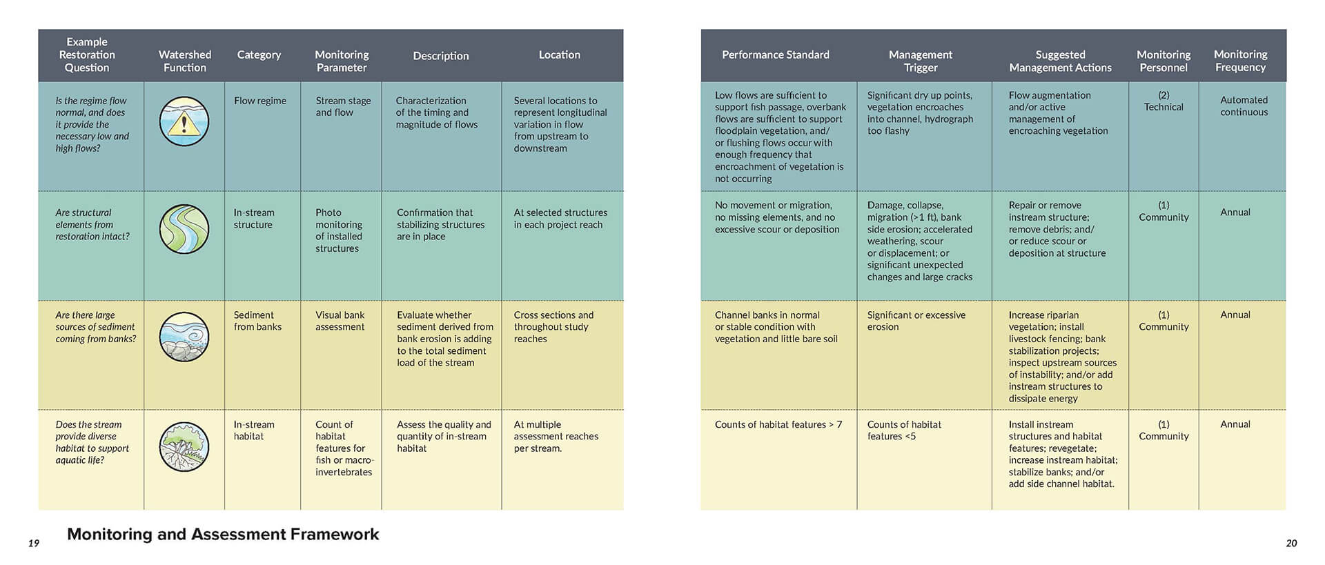
The conceptual model depicts the evolution of the watershed over time, arranging the nine watercolor paintings into grid by timeframe and landscape position. LVB also adapted the illustrations and text and charts provided by the Watershed Center into the graphic design of a small-format Adaptive Management Guidebook.
The watershed group chose to create an illustrative conceptual model to enhance understanding and inspire deeper critical thinking regarding the watershed’s future.Watershed coordinators use the conceptual model to engage stakeholders, from policymakers to landowners. In addition, a coloring book format engages elementary school students in hands-on watershed science education.
The project was funded by the Colorado Department of Local Affairs Community Development Block Grant – Disaster Recovery Resiliency Planning Program, June 2018.
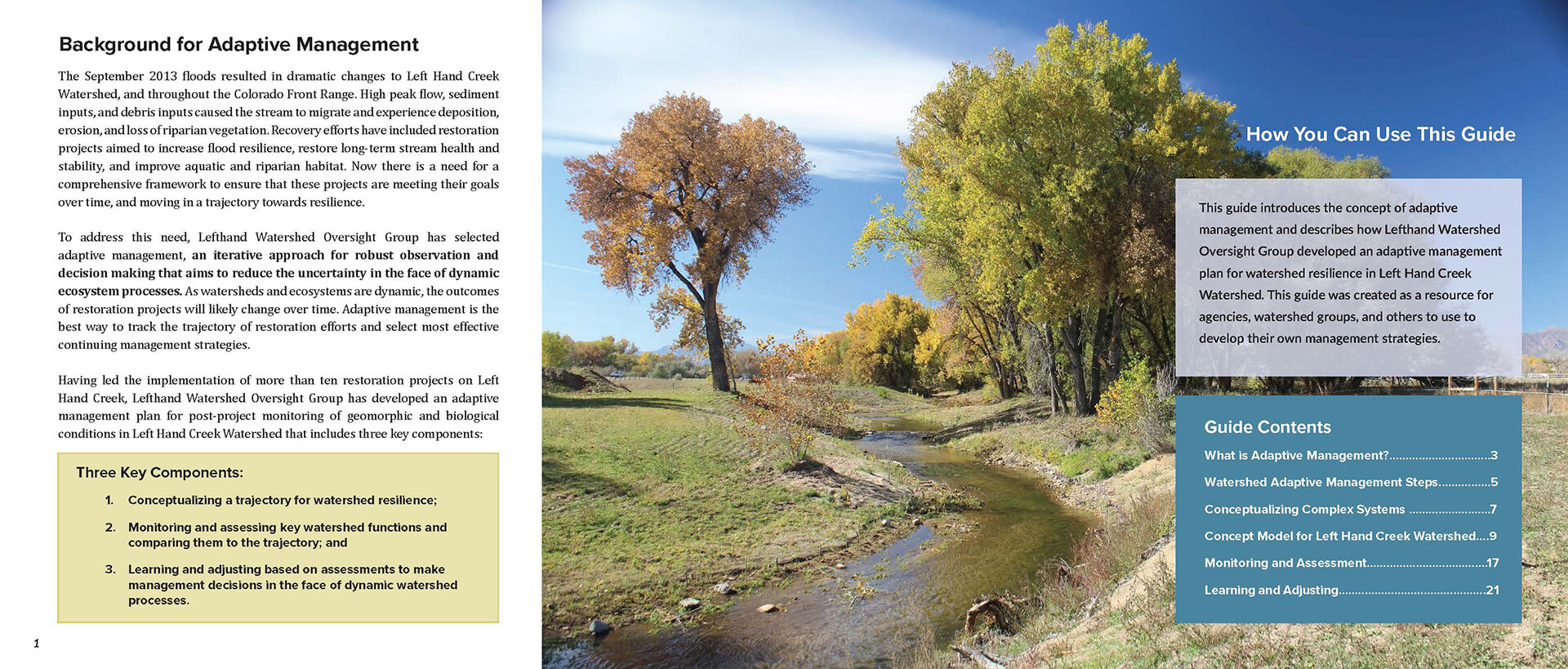
ADAPTIVE MANAGEMENT GUIDEBOOK EXCERPTS
Click image to expand and scroll through pages of the guidebook.

