Illustrated Map | Trailhead Kiosk Design
LeRoy Oakes Forest Preserve Illustrated Map & Welcome Sign
Client: Forest Preserve District of Kane County | Illinois
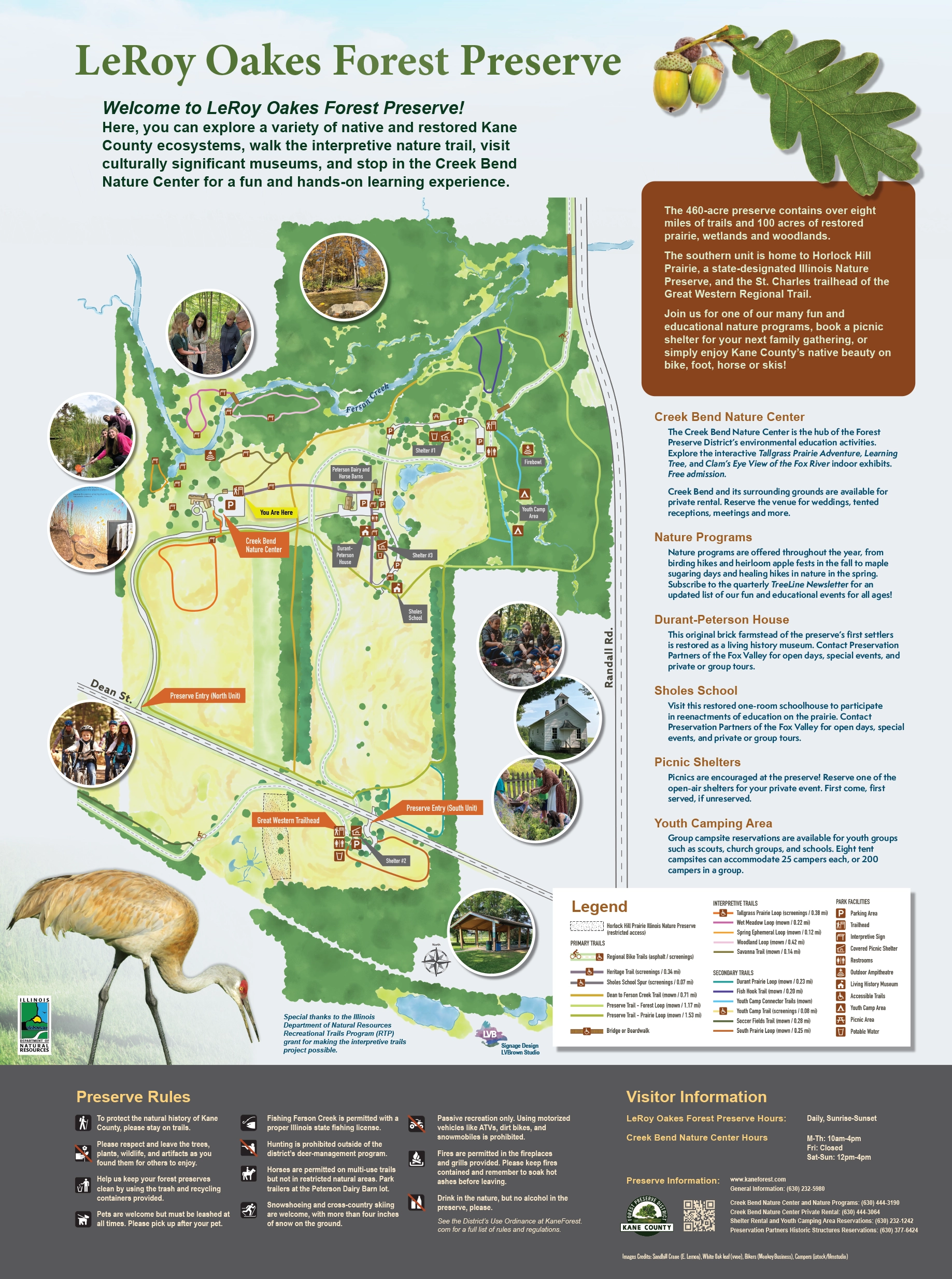
This illustrated preserve map and trailhead welcome sign is the gateway to LeRoy Oakes Forest Preserve’s new interpretive trail system. As part of the larger project funded by an Illinois DNR RTP grant, LVBrown Studio developed an illustrated map for the entire 450-acre LeRoy Oakes Forest Preserve, the District’s premiere forest preserve open space.
The goal of the map was to clearly indicate what visitors can see and do within the preserve: from visiting the interactive displays inside Creek Bend Nature Center, exploring the many miles of hiking and biking trails, touring the living history museums, or joining one of the District’s many outdoor educational programs.
Basemaps were created in GIS with trail data provided by the client. LVB provided site analysis of the park property and consultation on trail naming. The final map is a digital rendering in a watercolor style with vector-based diagram elements. LVB also composed signage text and graphic design for the final welcome signage panel.
Lauren developed a visually stunning, spatially accurate welcome sign/trail map for the 450-acre preserve that, for the first time in the site’s history, tied together all of its natural and cultural features to maximize the visitor experience. – Barb McKittrick, Environmental Education Manager (FPDKC)

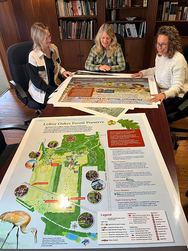
Forest Preserve District of Kane County staff and LVBrown Studio at the Creek Bend Nature Center reviewing full size proofs of interpretive trails signage before final press; illustrated preserve map in the foreground. Photo by FPDKC

